Water Jurisdiction
This page is to provide information to seasteaders of where best to seastead without government interference.
Contents
Goals for this page.
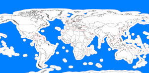
- To create a visual map of treaties, patrols, shipping lanes and military authority over water.
- To create a heatmap demonstrating the level of enforcement of national waters
- Possibly to cross reference this with relevant information on seastead viability such as hurricane paths.
International waters agreements
The following section is from the wikipedia entry on international waters. This could do with editing down to treaties of importance to seasteading only, and cross referenced with a map.
Global agreements
- International Freshwater Treaties Database (freshwater only).
- The Yearbook of International Cooperation on Environment and Development profiles agreements regarding the Marine Environment, Marine Living Resources and Freshwater Resources.
- 1972 London Convention on the Prevention of Marine Pollution by Dumping of Wastes and Other Matter (London Convention 1972)
- 1973 London International Convention for the Prevention of Pollution from Ships, 1973 MARPOL
- 1984 United Nations Convention on Law of the Sea (United Nations Convention on Law of the Sea, United Nations - especially parts XII-XIV.)
- 1997 United Nations Convention on the Law of Non-Navigational Uses of International Watercourses (CIW) - not ratified
- Transboundary Groundwater Treaty, Bellagio Draft - proposed, but not signed
- Other global conventions and treaties with implications for International Waters:
- 1971 Ramsar Convention on Wetlands (Text of Ramsar Convention and other key original documents)
- 1992 Convention on Biological Diversity Text of the Convention on Biological Diversity especially Articles 12-13, as related to transboundary aquatic ecosystems)
Regional agreements
At least ten conventions are included within the Regional Seas Program of UNEP, including:
- the Atlantic Coast of West and Central Africa (Convention for Co-operation in the Protection and Development of the Marine and Coastal Environment of the West and Central African Region; and Protocol (1981)
- the North-East Pacific (Antigua Convention);
- the Mediterranean (Barcelona Convention);
- the wider Caribbean (Cartagena Convention);
- the South-East Pacific (Lima Convention, 1986);
- the South Pacific (Nouméa Convention);
- the East African seaboard (Nairobi Convention, 1985);
- the Kuwait region (Kuwait Convention);
- the Red Sea and the Gulf of Aden (Jeddah Convention).
Addressing regional freshwater issues is the 1992 Helsinki Convention on the Protection and Use of Transboundary Watercourses and International Lakes (UNECE/Helsinki Water Convention)
Water body-specific agreements
- Baltic Sea (Helsinki Convention on the Protection of the Marine Environment of the Baltic Sea Area, 1992)
- Black Sea (Bucharest Convention,1992), see also the Black Sea Commission;
- Caspian Sea (Framework Convention for the Protection of the Marine Environment of the Caspian Sea, 2003)
- Lake Tanganyika (Convention for the Sustainable Management of Lake Tanganyika, 2003)
